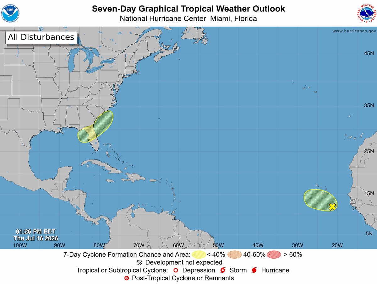
The National Hurricane Center is tracking a tropical wave in the far eastern Atlantic Ocean. According to Antigua News Room, forecasters expect the system to remain weak as it moves west-northwest away from the African coast.
The disturbance, located southeast of the Cabo Verde Islands, is producing disorganized showers and thunderstorms. The National Hurricane Center has indicated that while some gradual development is possible over the next day or two, environmental conditions are expected to become increasingly unfavorable by the weekend, reducing the likelihood of significant strengthening.
The system is currently moving west-northwest at approximately 10 mph (16 kph). Forecasters place the probability of the disturbance developing into a tropical depression at just 10 percent over both the next 48 hours and the next seven days.
Meteorologists note that the tropical wave is expected to encounter dry, dusty air from the Saharan Air Layer — a phenomenon known to suppress thunderstorm activity and inhibit tropical cyclone formation.
At this time, the disturbance poses no threat to the Caribbean, including Antigua and Barbuda, and no impacts are anticipated as the system continues its track over the open Atlantic. Forecasters say they will continue to monitor the wave for any signs of increased organization.