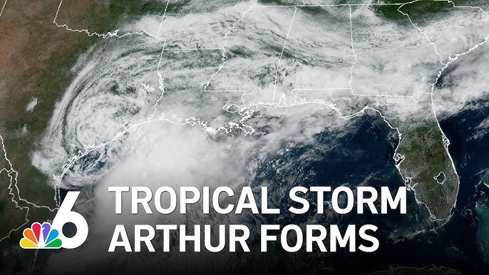
Tropical Storm Arthur formed Wednesday off the Gulf Coast of Texas, becoming the first named storm of the 2026 Atlantic hurricane season. According to Antigua News Room, the storm developed near the middle of the Texas coast, approximately 40 miles from Port O'Connor and 190 miles from Lake Charles, Louisiana.
The National Hurricane Center reported that Arthur was tracking northeastward with maximum sustained winds of 40 mph — just enough to meet the threshold for tropical storm classification. Forecasters indicated minimal changes in strength were expected as the storm moved toward the coastline, though Arthur was anticipated to accelerate as its centre tracked along or over coastal Texas before pushing into southern Louisiana and eventually turning inland to weaken.
Regardless of its precise path, the National Hurricane Center warned that Arthur would bring heavy rain and dangerous flooding across a broad stretch of the southeastern United States, stretching from Houston to Atlanta. Forecasters cautioned in an advisory that the storm was "expected to cause life-threatening flooding" along with powerful winds across parts of the region.
Tropical storm warnings were issued from High Island, Texas, to Morgan City, Louisiana, indicating tropical storm conditions were expected within 12 hours. A tropical storm watch was also placed in effect from Sargent, Texas, to High Island, signalling that such conditions were possible within the same window, though not guaranteed.
Arthur began developing earlier in the week as a tropical disturbance in the western Gulf of Mexico, strengthening as coastal communities in its path already grappled with intense rainfall that triggered dangerous flash flooding across multiple states.
Forecasters projected the storm would drop 5 to 10 inches of rain across sections of Texas, Louisiana, Mississippi, Alabama, and western portions of the Florida Panhandle. Storm surge could reach up to 4 feet above normal levels in coastal areas, depending on the timing of high tide.
"The deepest water will occur along the immediate coast near and to the east of the landfall location, where the surge will be accompanied by large and dangerous waves," the National Hurricane Center stated.
Authorities also warned of life-threatening surf and rip current conditions along the northwestern Gulf Coast for several days, with the additional possibility of isolated tornadoes.
The Atlantic hurricane season runs from June 1 to November 30, with activity typically peaking between August and October. Forecasters had predicted a below-average season, with the National Oceanic and Atmospheric Administration's latest outlook calling for eight to 14 named storms, of which three to five could develop into hurricanes.